Overview
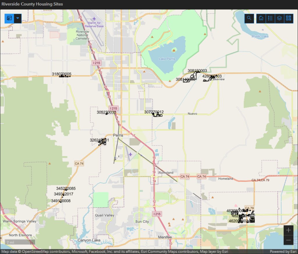
The Adequate Sites Inventory Web Map project was developed to assist Riverside County planners in identifying suitable sites for the Housing Element's Regional Housing Needs Assessment (RHNA) Allocation, with a particular focus on supporting affordable housing site identification. This initiative involved comprehensive data analysis and the creation of a customized web mapping application tailored to unincorporated Riverside County. A parcel-level review was conducted using criteria aligned with Housing Element requirements, resulting in a refined list of 297 potential sites. The application featured interactive map layers enabling staff to review and update site information. Widely used throughout the review process, the tool was also linked to a progress-tracking dashboard, helping staff monitor evaluation status and streamline compliance with state housing mandates.
Site Information
Locations
The County is relying on sites located across 9 area plans, which include 21 communities, to meet its regional housing need. Within each community, different neighborhoods are identified as appropriate for higher density development through a mixed-use area land use designation, mixed use zone classification, and area plan policies.
In order to reduce development cost and provide site flexibility, the Mixed Use Area (MUA) land use designation and Mixed Use (MU) zone was mapped to neighborhoods within area plans that were more connected to infrastructure, community services, and other resources.
Selection Criteria
The sites identified during the 6th Cycle Housing Element update were selected based on the following evaluation criteria:
1. Land use designation of HHDR/MUA
2. Availability of local community-supportive facilities and services
3. Availability of intra- and interregional transportation facilities
4. Availability of supportive on-site and site-edge land use and environmental characteristics
5. Availability of primary on-site infrastructure (roads, sewer, and water)
6. Flexibility in individual site development options
Image
Definitions
Highest Density Residential (HHDR):
- 14-60 dwelling units per acre (du/ac)
- Multi-family dwellings, includes apartments and condominium
- Multi-storied (3-plus) structures are allowed
Mixed Use Area (MUA):
This designation is applied to areas outside of Community Centers. The intent of the designation is not to identify a particular mixture or intensity of land uses, but to designate areas where a mixture of residential, commercial, office, entertainment, educational, and/or recreational uses, or other uses is planned.
Policy Areas:
Policy Areas are specific geographic districts that contain unique characteristics that merit detailed attention and focused policies. These policies may impact the underlying land use designations. At the Area Plan level, Policy Areas accommodate several locally specific land use designations.
Image

Determining Capacity
In an effort to determine each site’s realistic capacity, the County evaluated the implementation of its current multifamily development standards and on-site improvement requirements (e.g., setbacks, building height, parking, and open space requirements) as well as current development occurring in the County. It was determined that relying on the net acreage accounted for these requirements and was consistent with development.
Approximately 79 percent of the identified sites have the MUA land use, the remaining are HHDR. The MUA land use designation includes a HHDR requirement at a varying percentage of the site depending on its location within the County.
Large Sites
To assist in facilitating the development of affordable housing on larger parcels, the County will routinely give high priority and fast track authorization to processing subdivision maps that include affordable housing units (Action H-3). Also, the County will expedite the review process for the subdivisions of larger sites into buildable lots where the development application can be found consistent with the General Plan, applicable specific plan, and Program Environmental Impact Report 548.
The County is relying on 15 sites that are larger than 10 acres in size, with the largest being 47.19 acres.
Area Plan Capacity Summary | |||
Area Plan | Vacant - HHDR | Vacant - MUA Units | Total Units |
| Eastern Coachella Valley | 813 | 1,805 | 2,618 |
| Elsinore | 0 | 263 | 263 |
| Harvest Valley/Winchester | 29 | 1,425 | 1,454 |
| Highgrove | 260 | 179 | 439 |
| Lakeview/Nuevo | 151 | 1,539 | 1,690 |
| Mead Valley | 516 | 834 | 1,350 |
| Temescal Canyon | 0 | 0 | 0 |
| The Pass | 487 | 1,383 | 1,870 |
| Western Coachella Valley | 17 | 6,696 | 6,713 |
| Total | 2,273 | 14,112 | 16,397 |
| Source: Riverside County, September 2021 | Housing Element Table P-33 | |||
Sites Inventory Table
The County prepared a site inventory using its geographic information system (GIS) to identify vacant parcels that could readily be developed to meet the County’s Regional Housing Needs Allocation (RHNA).
The identified sites are located across nine area plans, encompassing 21 communities. This geographic distribution provides site flexibility and accounts for development costs by prioritizing proximity to infrastructure, community services, and other various resources.
Additional Information
To learn more about the County’s Regional Housing Needs Assessment (RHNA) allocation, housing goals, policies, and program requirements, visit the 6th Cycle Housing Element webpage.
Coming Soon!
Contact Us
Jordan Leffew | Assistant Planner
Chad Brown | Senior Planner
Phayvanh Nanthavongdouangsy | Principal Planner
[email protected]
(951) 955-2525
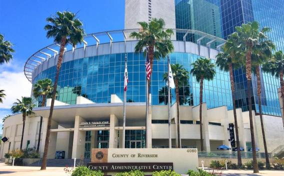
County Administrative Center
12th Floor - Planning Department
4080 Lemon Street, 12th floor
Riverside, CA 92502
(951) 955-2004
Image